Devil’s Bunker
Enjoy the captivating experience of these 360-degree panoramic images, which offer a unique and immersive glimpse into a piece of history. These images have been captured at an intriguing location known as the Devil’s Bunker, a site abandoned since World War II. This bunker, mounted along the dramatic cliffs of California, presents a haunting yet fascinating view into the past. The panoramic nature of the images allows viewers to fully engage with the surroundings, providing a comprehensive view of the bunker’s structure and the stunning natural landscape that surrounds it. This virtual exploration brings to life a forgotten piece of wartime history, nestled on the rugged coastline of California.
Image by: Daniel Lanovaz
Image by: Chris “Vectrexer” Romero
Image by: Chris “Vectrexer” Romero
About the Abandoned Location
The Devil’s Slide Bunker, perched high above Gray Whale Cove State Beach in San Mateo County, California, is a relic of World War II history. This intriguing structure was built as part of the Little Devils Slide Military Reservation, one of five fire control stations established by the United States Army for the harbor defense of San Francisco during the war. Its primary function was as a triangulation and observation station, crucial for detecting and relaying information about enemy ships.
Constructed during World War II, the Devil’s Slide Bunker was integral to the United States’ coastal defense strategy, particularly against potential Japanese naval attacks. Military personnel stationed at the bunker utilized binoculars and compasses to scan the sea for enemy vessels. By coordinating with other observation posts, they could accurately determine the location of ships through triangulation. This process was vital before the advent of radar technology.
The Devil’s Slide area housed six military structures: three concrete and steel observation pill-boxes, two concrete-and-earth bunkers, and a reinforced steel observation tower. The bunker played a significant role in communications and command operations.
However, with the advancement of radar technology, the bunker’s role diminished, leading to its abandonment in 1949. The land was eventually bought by a private owner in 1983. While the other buildings were removed, the bunker remained and stands today, albeit in a state of decay and covered in graffiti.
Despite its derelict state, the Devil’s Slide Bunker remains a testament to a critical period in U.S. history, reflecting the strategic importance of the San Francisco Bay area during World War II. The history of the bunker, its role in coastal defense, and its eventual obsolescence and abandonment offer a glimpse into the evolving nature of military technology and strategies. You can view more images of the bunker on Google Maps.
If you liked exploring and learning about this location in, you might like the following as well. The Rochelle School House in Florida, the Ruins of Paricatuba in Brazil, or the Operations Control Building at the Cape Canaveral Space Force Station.
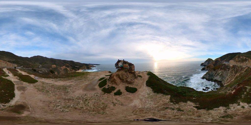
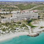
An aerial 360-degree panoramic image captured above the abandoned Devil’s Bunker along the Pacific Ocean in California. Image by Daniel Lanovaz
Do you have 360-degree panoramic images captured in an abandoned location? Send your images to Abandonedin360@gmail.com. If you choose to go out and do some urban exploring in your town, here are some safety tips before you head out on your Urbex adventure.
Unlock the secrets of exploration by diving into precise GPS data available exclusively for an array of hidden gems and hundreds of other captivating sites, all within our members’ section. By investing in a Gold Membership, you’re not just gaining access; you’re securing a key to a vast, global archive of abandoned, untouched, and mysterious locations waiting to be discovered. Embark on your adventure with confidence, knowing every corner of the world can be within your reach. Don’t just observe—explore, discover, and claim the extraordinary journey that lies ahead with our treasure trove of world secrets. Subscribe now and transform the way you see the world!
Click on a state below and explore the top abandoned places for urban exploring in that state.


