Chernobyl Exclusion Zone
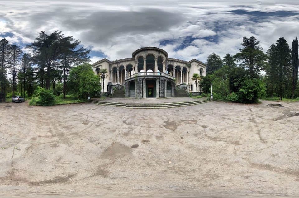
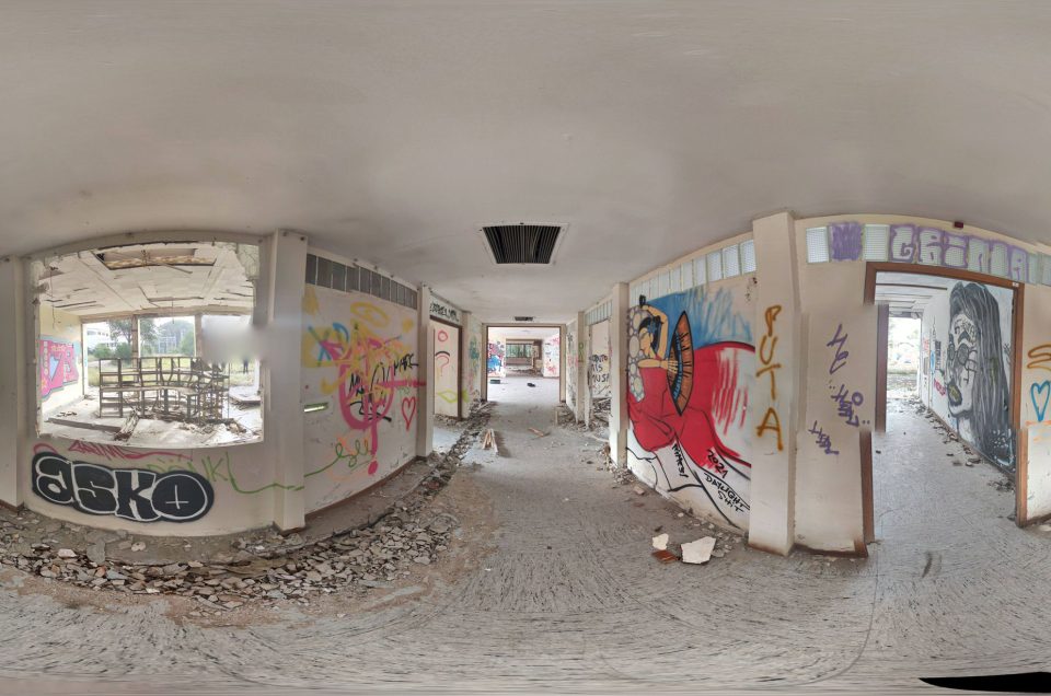
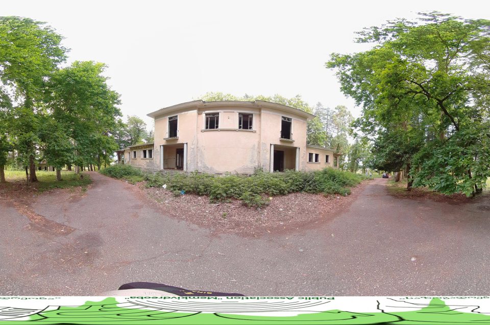
Discover the eerie beauty of the Chernobyl Exclusion Zone through an immersive experience with our 360-degree panoramic images on Google Maps Street View. As an urban explorer, you’ll appreciate the haunting allure and historical significance captured in each detailed panorama. Take your time to navigate through the various images below, exploring every corner and uncovering hidden stories at your own pace. Each panorama offers a unique perspective, allowing you to delve deeper into this enigmatic landscape.
Image above were captured by Nikolai Fomin
Image above were captured by Mykola Omelchenko
Image above were captured by Gamma Travel
Image above were captured by Nikolai Fomin
Image above were captured by Mykola Omelchenko
Image above were captured by WhiteSoldier86
Image above were captured by Bartosz Bryniarski – BiGsystem
Exploring the Chernobyl Exclusion Zone
The Chernobyl Exclusion Zone, located in Ukraine, is one of the most radioactive locations in the world. Over the last few years, it’s become a hotspot for those to explore the ruins of the surrounding towns and villages within the excursion zone.
The zone now covers an expansive 1,500 square miles and was established in response to the Chernobyl Nuclear Power Plant disaster that occurred in 1986. Military forces moved in to evacuate thousands of people from their homes within 30 hours after the explosion, most never to return. Today, although there is a small range of radiation levels throughout the zone, visitors can visit through an approved guide.
The Chernobyl Nuclear Power Plant History
The Chernobyl Nuclear Power Plant, located in Ukraine, is the site of a disastrous accident that occurred on April 26, 1986. Early in the morning, workers were preparing to perform routine tests on the emergency water cooling system designed to continue operations in the event of a power outage. Within seconds of initiating the test, an uncontrolled reaction caused steam to build up in Reactor Number 4. With nowhere to go, the steam exploded through the reactor’s 2,000-ton roof, sending plumes of radiation into the atmosphere and burning radioactive debris.
Seconds after the first explosion, another explosion occurred, sending out more fuel, causing a fire to Reactor Number 3, and risking a breach of the facility. The safety systems that would have automatically activated in an emergency never kicked in as workers disabled them before the testing. It took over two weeks to extinguish all the fires due to nitrogen, sand, and lead fuel.
Evacuations began the next day in the neighboring town of Pripyat of their 50,000 citizens. In the subsequent weeks and months, over 67,000 more people were evacuated from surrounding areas which grew to over 200,000 people by the end. On May 2, 1986, the Soviet Union designated an area of 1040 square miles around the 18.6-mile radius around the plan as off limits and called it the Chernobyl Exclusion Zone.
The Chernobyl Excursion Zone Today
The Chernobyl Exclusion Zone was originally split into three distinct regions – The inner exclusion zone, the zone of temporary evacuation, and the zone of rigorous monitoring. The closer to the plant, the higher the radiation levels. As the years have gone by, the Chernobyl Exclusion Zone has expanded and now covers 1,550 square miles. The area remains inhabitable as so much has been left untouched for over 30 years and nature has begun to take over the location. Animals have thrived, despite the radiation levels, because of the lack of human disturbance.
Today, you can only visit the Chernobyl Excursion zone with an approved guide to explore the ruins of the surrounding villages and towns. The radiation levels in the approved zones are comparable to an x-ray scan. Visitors are scanned upon entering and leaving the excursion zone to check radiation levels and are encouraged to leave any items with high radiation levels behind. There are rules to follow, and it advises you to watch out for wildlife and avoid touching anything.
People can explore abandoned amusement parks, apartment buildings, schools, and more as they enter a Soviet Union time capsule essentially. Explorers are encouraged to take care when visiting and be mindful and respectful of the places left behind. If you are brave enough, you have an opportunity to visit Reactor Number 4 control room, although radiation levels could be as high as 40,000 times higher than normal.
Other abandoned locations in Pripyat you might like, the Palace of Culture Energetik, the Cafe Pripyat, the Pripyat amusement park, or you can find all the abandoned locations we have posted about by searching the Pripyat tag on our site.
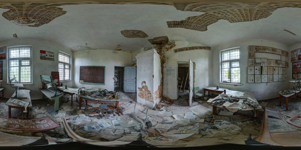
A 360-degree panoramic image captured inside the Chernobyl Exclusion Zone by photographer Nikolai Fomin
Do you have 360-degree panoramic images captured in an abandoned location? Send your images to Abandonedin360@gmail.com. If you choose to go out and do some urban exploring in your town, here are some safety tips before you head out on your Urbex adventure.
Unlock the secrets of exploration by diving into precise GPS data available exclusively for an array of hidden gems and hundreds of other captivating sites, all within our members’ section. By investing in a Gold Membership, you’re not just gaining access; you’re securing a key to a vast, global archive of abandoned, untouched, and mysterious locations waiting to be discovered. Embark on your adventure with confidence, knowing every corner of the world can be within your reach. Don’t just observe—explore, discover, and claim the extraordinary journey that lies ahead with our treasure trove of world secrets. Subscribe now and transform the way you see the world!
If you want to start shooting 360-degree panoramic images, you might want to look onto one-click 360-degree action cameras.
Click on a state below and explore the top abandoned places for urban exploring in that state.
